This page surveys the physical setting, climate, hydrology, eco‑regions, regions/subregions, and major settlements across the Kurdish highlands and adjoining foothills. It highlights mountain systems of the Zagros–Taurus arc, river basins, seasonal patterns, biodiversity, and land use.
Geographic Overview of Kurdistan
Definition: A historical–cultural region inhabited by Kurds, without a single unified state, spanning multiple countries and a wide diaspora.
- Turkey: Southeastern Anatolia (Northern Kurdistan).
- Iraq: Northern Iraq (Southern Kurdistan).
- Syria: Northern Syria (Western Kurdistan).
- Iran: Northwestern Iran (Eastern Kurdistan).
- Diaspora: Europe, North America, and the broader Middle East.
Physical Setting
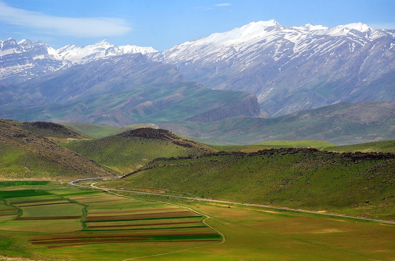
The Kurdish geographic region lies across the northern and north‑eastern arc of Mesopotamia, where the Zagros and Taurus mountains meet the plateaus of Anatolia and the Iranian plateau. Elevations climb from steppe and piedmont (400–900 m) to high ridges over 3,500 m, producing steep climatic and ecological gradients.
Tectonics and Relief
- Orogeny: The Arabian plate colliding with the Eurasian plate uplifts the Zagros–Taurus belt.
- Relief: Fold‑and‑thrust ridges, narrow valleys, and karstic plateaus; extensive limestone.
- High peaks: Halgurd (3,607 m), Cheekha Dar (~3,611 m, often cited), Qandil and Hakkari ranges.
Climate
Climate ranges from cold semi‑arid and continental in highlands to Mediterranean in foothills. Winters are cold and snowy at elevation; summers are hot and dry in lowlands.
- Precipitation: 400–1,200 mm/yr, peaking Nov–Apr; rain‑shadow effects leeward of major ridges.
- Snowpack: Accumulates on high ridges, feeding spring melt and river discharge.
- Heat: Foothills and basins see summer maxima exceeding 40°C; uplands remain cooler.
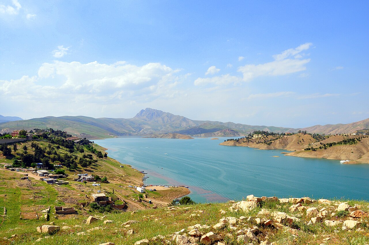
Hydrology: Rivers, Lakes, and Dams
Most rivers drain into the Tigris–Euphrates system. Tributaries rise in the highlands, carving deep gorges and sustaining agriculture downstream.
- Great Zab (Zêyê Mezin) and Little Zab (Zêyê Biçûk): Major Tigris tributaries; canyon reaches and irrigation oases.
- Diyala/Sirwan: Originates near the Zagros crest, passing through Darbandikhan.
- Khabur/Jagjagh and upstream wadis of the Jazira plains.
- Lakes and reservoirs: Dukan, Darbandikhan, Mosul; seasonal wetlands in intermontane basins.
Topography
Mountain ranges
- Zagros Mountains: From western Iran into southeastern Iraq; a backbone of Eastern Kurdistan.
- Taurus Mountains: Southern Turkey; prominent across Northern Kurdistan.
- Kandil Mountains: Along the Iraq–Iran border; rugged massifs and remote valleys.
- Kurdish Plateau: Broad steppe‑like uplands across Northern and parts of Eastern Kurdistan.
Notable peaks
- Mount Ararat (Ağrı Dağı, Turkey): 5,137 m, iconic in regional traditions.
- Mount Hakkari (Turkey): High alpine terrain and tribal summer pastures.
- Mount Ranya (Iraq): Landmark summit within the Kurdistan Region.
Valleys and river systems
- Tigris and Euphrates: Lifelines for settlement and agriculture across Turkey, Syria, and Iraq.
- Great Zab: Major tributary of the Tigris flowing through Iraqi Kurdistan.
- Khabur: Feeds Western Kurdistan agriculture in Syria and Turkey.
Caves and natural formations
- Shanidar Cave (Iraq): Major archaeological site with Neanderthal remains.
- Gabar and Bekhair caves (Turkey/Iraq): Shelters associated with conflict periods.
Regions and Subregions
Geographers often distinguish interlinked subregions shaped by elevation, river basins, and historical routes:
- Bahdinan (northwest highlands): Duhok governorate and adjoining districts; oak woodlands, karst springs.
- Soran (central highlands): Erbil governorate uplands, Halgurd–Sakran massif, Great Zab canyons.
- Garmian (foothills/steppe): Between Little Zab and Diyala; steppe agriculture, seasonal rivers.
- Mukriyan (northwest Iran): Intermontane basins and markets linking plateau and Mesopotamia.
- Hawraman/Uramanat: Terraced villages on steep limestone ridges; distinctive architectural heritage.
- Hakkari–Qandil: Rugged Taurus–Zagros hinge with deep gorges and summer pastures.
- Jazira: Northern Mesopotamian plains between Tigris and Euphrates with dryland farming.
- Shingal/Sinjar: Isolated limestone massif rising from plains, with unique microclimate.
Major Cities and Towns
Urban centers cluster in basin floors and valley corridors, connecting highland markets to lowland trade.
- Erbil (Hewlêr): Historic citadel, a major administrative and commercial hub.
- Sulaymaniyah: Cultural and educational center near the Zagros foothills.
- Duhok: Northern gateway between Taurus foothills and Jazira plains.
- Sanandaj (Sine) & Kermanshah: Plateau cities with long craft and literary traditions.
- Mahabad: Market town in the Mukriyan basin.
- Diyarbakır (Amed): Upper Tigris city with basalt walls and river terraces.
- Van: Lake basin with volcanic landforms on the Anatolian plateau.
- Qamishli: Jazira trade node on the upper Khabur plain.
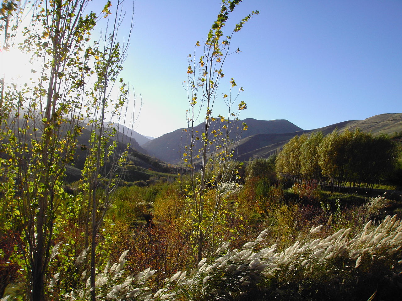
Ecology and Biodiversity
Elevation and exposure produce a mosaic of eco‑regions: oak steppe woodlands, montane grasslands, alpine meadows, riparian corridors, and semi‑arid shrublands.
- Flora: Persian oak (Quercus brantii), pistachio, wild almond; spring bulbs and herbs.
- Fauna: Bezoar ibex, brown bear, wolf, lynx; migratory birds along river valleys.
- Threats: Overgrazing, wildfire, drought cycles, and habitat fragmentation.
Climate and Weather Patterns
- Continental climate: Hot summers and cold winters over much of Kurdistan.
- Summer: Lowland temperatures can exceed 40°C; highlands remain cooler.
- Winter: Snow and freezing temperatures are common in mountainous areas.
- Highland climate: More temperate conditions with higher rainfall year‑round.
- Precipitation: Greatest on windward Zagros/Taurus slopes; lower across plateaus and basins.
- Semi‑arid zones: Mesopotamian plain extends into parts of Iraqi Kurdistan.
Land Use and Economy
- Agriculture: Wheat, barley, pulses, orchards; irrigation in riverine oases; vineyards in suitable basins.
- Pastoralism: Transhumance from lowland wintering to highland summer pastures.
- Tourism: Mountain resorts, waterfalls, caves, and cultural heritage itineraries.
Infrastructure and Energy
- Mountain highways link valley cities via passes and tunnels; seasonal closures in heavy snow.
- Dams and hydropower on the Zab and Diyala/Sirwan systems; local micro‑hydro in uplands.
- Renewables potential: ridge‑top wind corridors; high solar insolation in piedmont.
Natural Hazards
- Earthquakes along the active Zagros belt; preparedness and building standards are critical.
- Drought and heatwaves affecting rain‑fed agriculture and rangelands.
- Landslides/flash floods in steep catchments during intense spring storms.
Protected Areas and Conservation
- Halgurd–Sakran National Park: High‑alpine habitats and endemic species.
- Local nature reserves safeguarding wetlands and woodland patches.
- Community forestry and rangeland management initiatives.
Natural Resources
Oil
- Iraq (KRI): Significant reserves near Kirkuk, Mosul, and Zakho underpin regional revenues.
- Syria: Kurdish‑controlled areas (e.g., Hasakah) include producing fields.
Minerals
- Coal: Deposits reported in parts of Iraqi Kurdistan.
- Limestone, copper, lead: Occur within belts across Iran/Iraq uplands.
Water resources
- Numerous rivers, streams, and springs across mountain catchments.
- Hakkari plateau (Turkey) and Sulaymaniyah (Iraq) contain notable lakes and streams.
Agriculture
- Valleys/alluvium support wheat, barley, fruit orchards (apples, grapes), and vegetables.
- Highlands favor sheep/goat herding within transhumant systems.
Regional Subdivisions
Turkey (Northern Kurdistan)
- Provinces: Diyarbakir, Hakkari, Van, Mardin, Batman, Şırnak, others.
- Topography: Rugged Taurus/Zagros arcs and intermontane basins.
Iraq (Southern Kurdistan)
- Governorates: Duhok, Erbil, Sulaymaniyah, Kirkuk.
- Topography: Mountainous north; fertile plains along the Tigris.
Syria (Western Kurdistan)
- Regions: Afrin, Kobane, Jazira, Hasakah.
- Topography: Plains with hills; mountains in Afrin.
Iran (Eastern Kurdistan)
- Provinces: Kermanshah, Kurdistan, West Azerbaijan.
- Topography: Dominated by Zagros ridges and intermontane basins.
Environmental Issues
- Deforestation: Logging, wildfire, and conflict‑related loss in Turkey, Iraq, Syria.
- Water scarcity: Dams (e.g., Ilisu) and droughts reduce downstream flows and irrigation.
- Climate change: More frequent droughts/heatwaves and erratic rainfall patterns.
- Pollution: Industrial and conflict damage to urban and peri‑urban environments.
Strategic Importance of Geography
Geopolitical significance
- Crossroads among Turkey, Iran, Iraq, and Syria—corridor linking Anatolia, Mesopotamia, and Iran.
- Mountain barriers confer defensive advantages and complicate external control.
- Proximity to oil‑rich areas (e.g., Kirkuk) elevates economic and geopolitical stakes.
Military and refugee issues
- Rugged terrain has supported guerrilla warfare in multiple conflicts.
- Region has seen large refugee/IDP movements during the 20th–21st centuries.
Maps and Coordinates (Selected Landmarks)
- Erbil Citadel: ~36.19°N, 44.01°E
- Halgurd peak: ~36.68°N, 44.89°E
- Lake Dukan: ~35.95°N, 44.96°E
- Hawraman terraces: ~35.27°N, 46.27°E
- Van Lake basin: ~38.56°N, 43.33°E
Further Reading
- Geomorphology and tectonics of the Zagros–Taurus orogen.
- Hydrology and water management in the Tigris–Euphrates basin.
- Eco‑regions and conservation strategies for oak steppe woodlands.